Travel | 旅游

Peru. Inca Trail.

2013 Nov. Inca Trail Trek (4 Days) to Machu Picchu.

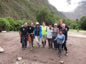
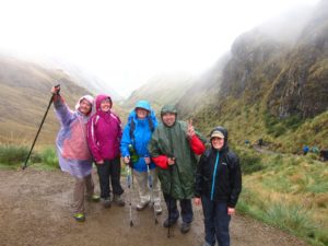
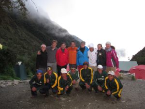
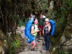
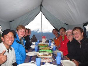
Inca Trail is one of the most well known sacred pilgrimages around the world. This 4-day trek through the Urubamba Valley towards the citadel of Machu Picchu is definitely an unique once-in-a-lifetime experience. I was really blessed to have awesome local guides and wonderful hiking companions, which made the trek so fun and memorable.

Day 1

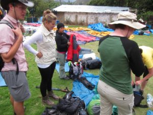
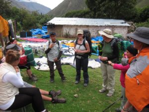
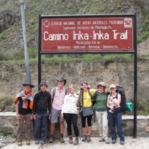
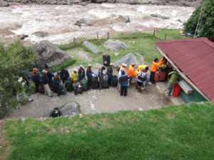
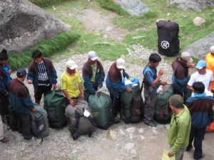
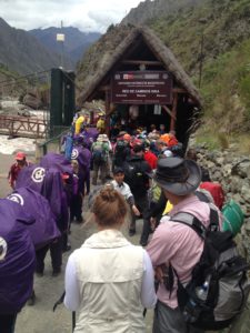
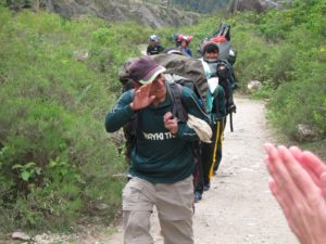
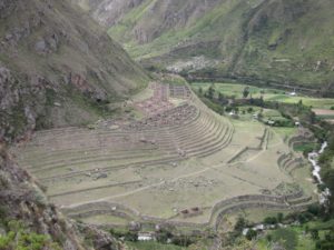
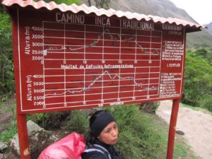
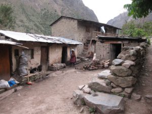
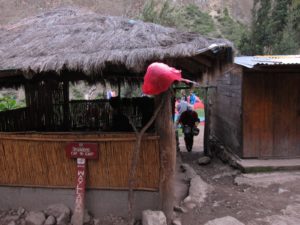
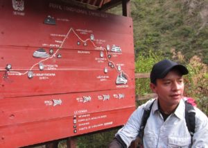
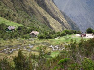
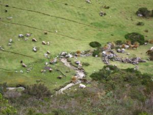
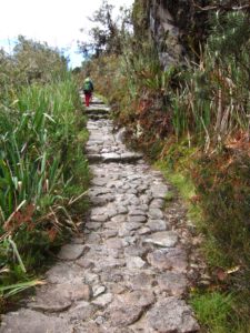
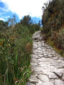
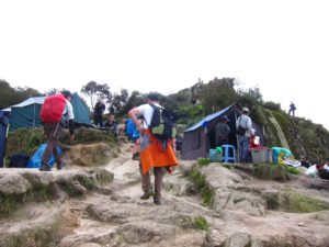
Inca Trail starts at Piscacucho/KM82 where we began our hike to Wayllabamba.

  • Day 1 – Hike distance: 7.5 miles (12km)
  • Minimum altitude: 8,860ft (2,700m)
  • Maximum altitude: 9,840ft (3,000m)
  • Approximate time: 5 to 6 hrs
  • Gradient: Moderate
equipment collection
Collect and pack equipment for our 4-day trek
Edgar and Jessica
Briefing by our guides Edgar & Jessica
Start of Inca Trail
Getting ready at the start of the Inca Trail, looking fresh and excited about the adventure

weigh station
Weigh station for porters’ load
heavy loads
The heroes who carried heavy loads to make our camping trip so comfortable
checkpoint entrance
Checkpoint entrance before crossing the suspension bridge
waykis
Porters, aka waykis, for our group
Inca ruins Llactapata
Llactapata
More views of Llactapata
lunch stop
First lunch stop. Our group was very happy but I saw 2 ladies from another group tearing, probably mentally unprepared for this trek. 🙂
porters turned chefs
Our waykis transformed as chefs to prepare our lunch
lunch table
Lunch table nicely set up under a teenage waiting for us
local and international dishes
Well fed with local and international dishes cooked by our porters, who carried everything and ran ahead of us to prepare our meal.
flat terrain for day one
Day 1 is mostly flat terrain
local hut along Inca Trail
Local hut along the trail where we camped for the first night
rustic and simple place
Rustic and simple place to set up our tents
Tents and washing basins awaiting
Tents and washing basins awaiting us upon arrival
camping
Everything thoughtfully taken care off by our porters who ran ahead despite carrying heavy loads
tea time
Popcorn, cookies and drinks served for late afternoon tea
amazing spread for dinner
Dinner served shortly after. Amazing spread whipped up using simple equipment and limited resources

Day 2

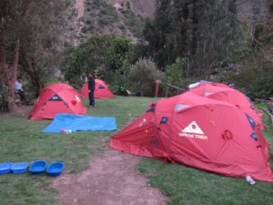
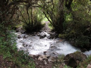
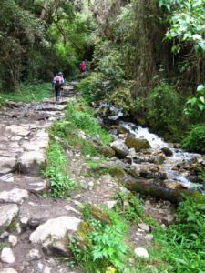
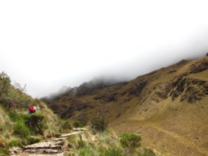
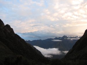
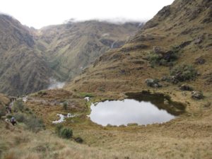
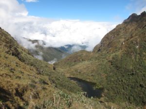
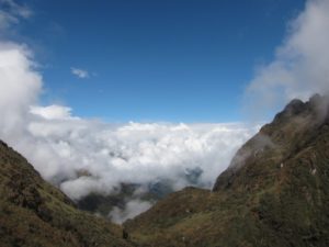
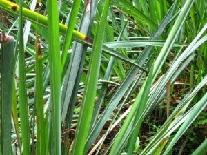
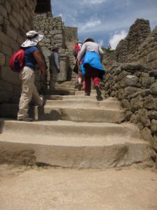
Day 2 was a tough day starting by zigzagging up the mountain. The weather took a bad turn and started to rain. After passing over the highest peak of Abra de Warmiwañusca, known as “Dead Woman’s Pass” in the rain, we continued to hike down a steep descent to Pacaymayo Valley.

  • Day 2 – Hike distance: 5.6 miles (9 km)
  • Minimum altitude: 9,840 ft (3,000m)
  • Maximum altitude: 13,780 ft (4,200m)
  • Approximate time: 6 to 7 hrs
  • Gradient: Challenging
Edgar
Our guide Edgar, briefing and preparing us mentally for the uphill climb on the second day

IMG_1143

IMG_1144

IMG_1146

IMG_1148

IMG_1149

IMG_1150

IMG_1156

IMG_1158

bad weather
Bad weather and rain made the uphill climb even tougher
dead woman pass
We conquered the Dead Woman’s Pass

IMG_1165

IMG_1167

appreciation night for waykis
Appreciation night for our wonderful waykis who took care of everything and made our trek so comfortable
group photo with waykis
Group photo with our waykis, who carried our equipment, prepared our tents, cooked and served us wonderful meals.
Flambe chocolate pudding
Flambe chocolate pudding as dinner dessert

Day 3

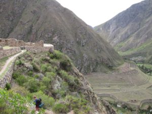
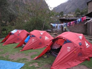
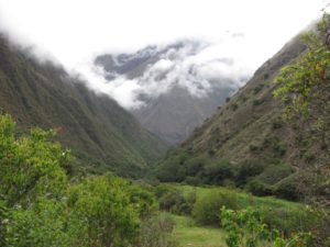
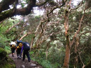
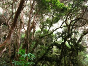
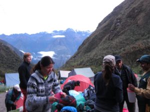
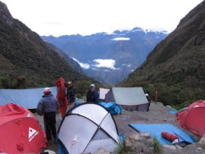
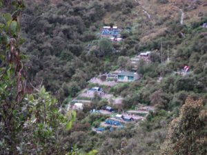
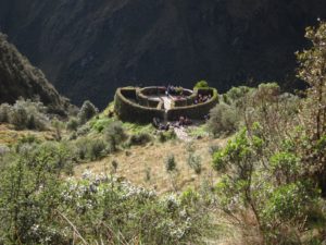
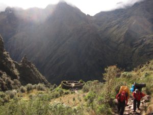
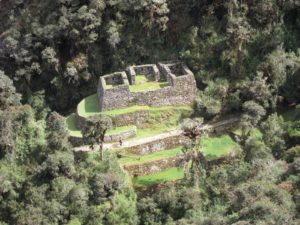
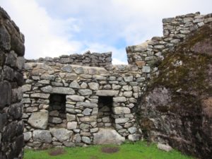
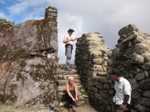
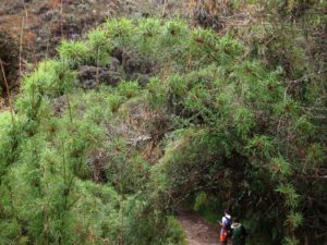
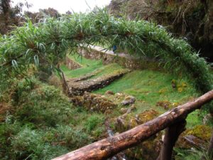
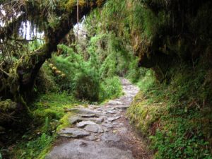
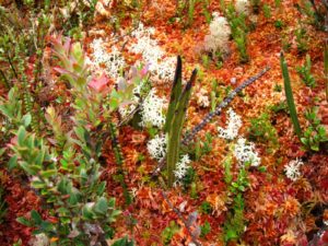
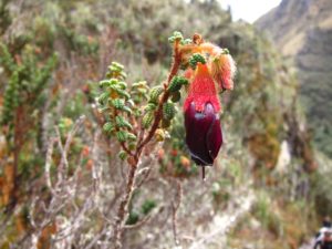
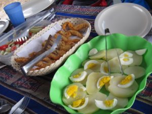
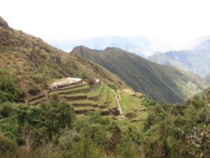
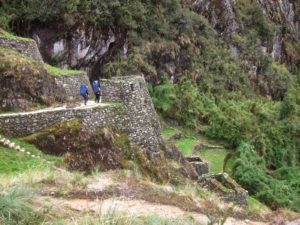
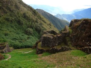
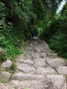
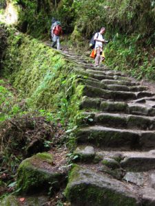
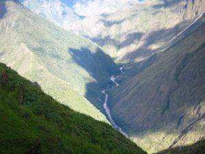
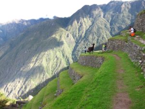
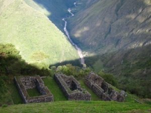
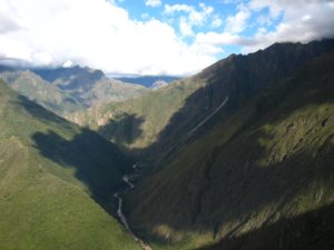
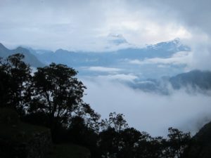
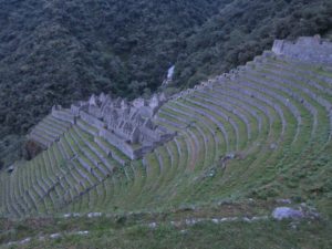
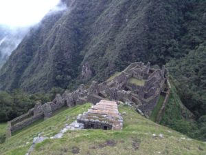
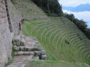
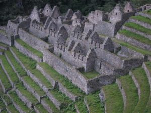
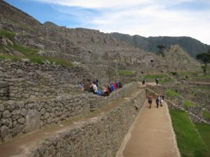
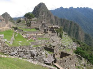
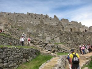
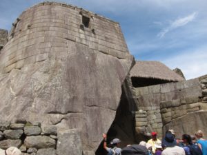
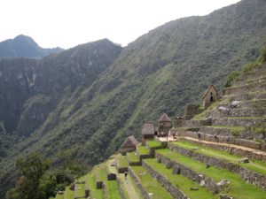
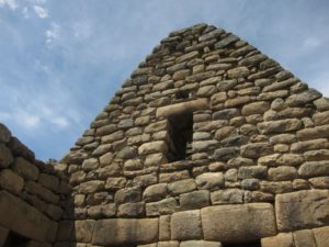
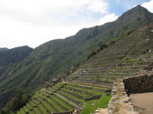
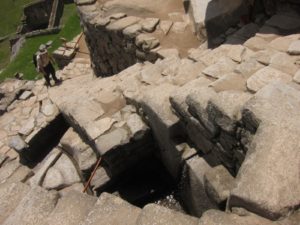
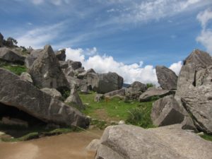
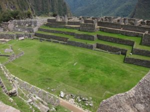
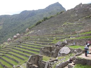
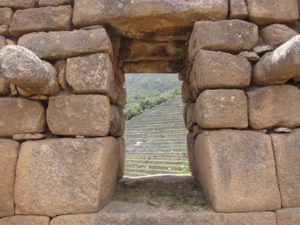
For Day 3, we passed through numerous Inca ruins, including Inca lodge Runkurakay; cliff-side Sayacmarca with panoramic views of Aobamba Valley; and Phuyupatamarca, one of the most distinctive sites on the trail. The cloud forest part of the trail was particularly pretty, but the trek downhill was tough on the knees. We spent the night at final campsite Wiñaywayna. Btw, don’t let any guidebook or website fool you in believing that there will be hot shower and beer available at the final campsite. 🙂 It was long closed for years when we arrived.

  • Day 3 – Hike distance: 9.3 miles (15km)
  • Minimum altitude: 8,860 ft (2,700m)
  • Maximum altitude: 12,960 ft (3,950m)
  • Approximate time: 8 to 9 hrs
  • Gradient: Moderate

IMG_1189

IMG_1178

IMG_1180

field toilet
Field toilet, but hiding and doing it in the wilderness is more fun

IMG_1190

IMG_1193

IMG_1197

IMG_1198

IMG_1203

IMG_1205

IMG_1208

IMG_1211

IMG_1218

IMG_1224

IMG_1225

IMG_1229

IMG_1233

cloudforest
Cloud forest part of the Inca Trail

IMG_1247

IMG_1264

IMG_1269

IMG_1270

IMG_1273

IMG_1276

IMG_1277

IMG_1278

IMG_1279

IMG_1282

IMG_1284

IMG_1298

IMG_1301

IMG_1302

IMG_1304

IMG_1307

IMG_1312

IMG_1320

IMG_1324

IMG_1330

IMG_1335

IMG_1336

IMG_1338

IMG_1342

IMG_1350

IMG_1352

IMG_1354

cake
Amazed how our chef baked a cake using portable gas stove

Day 4

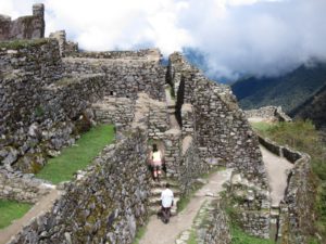
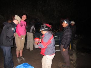
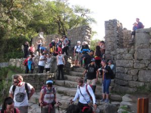
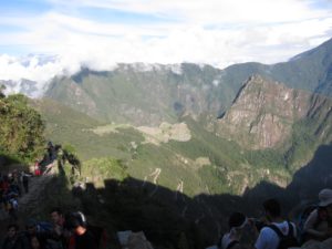
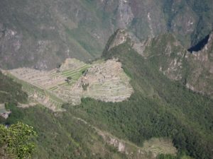
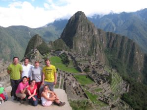
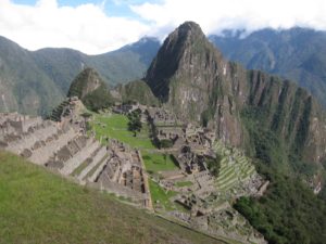
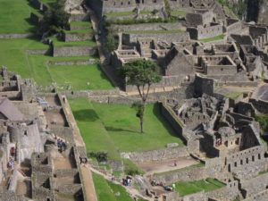
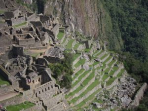
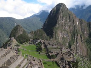
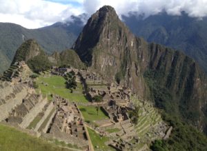
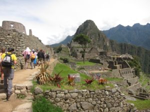
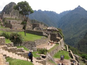
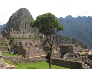
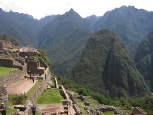
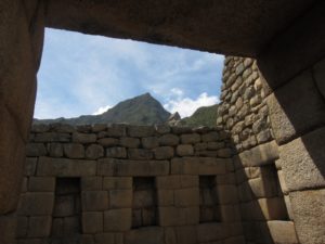
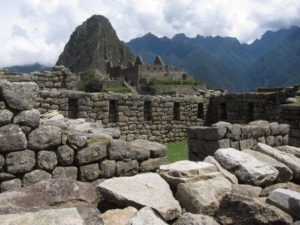
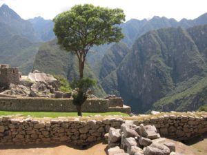
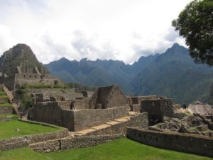
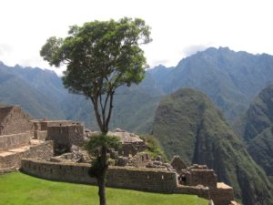
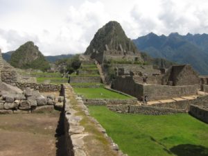
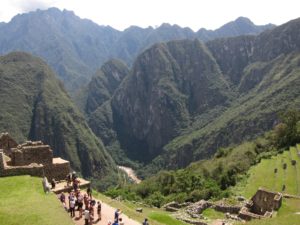
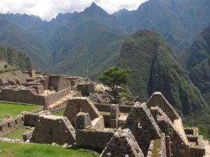
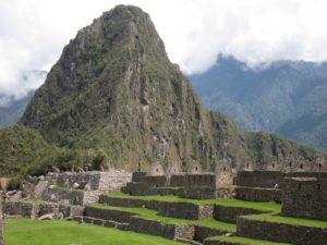
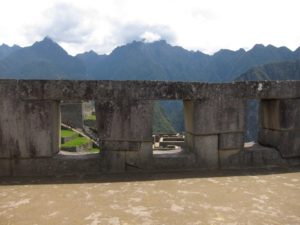
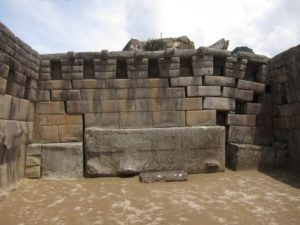
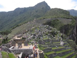
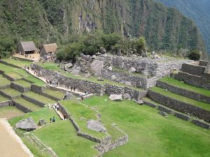
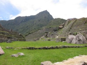
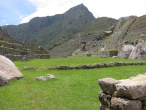
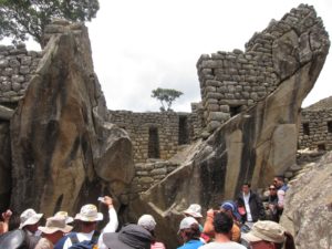
Woke up before dawn and started the one hour walk to Machu Picchu in the dark.

  • Day 4 – Hike distance: 2 miles (3km)
  • Minimum altitude: 7,875 ft (2,400m)
  • Maximum altitude: 8,860 ft (2,700m)
  • Approximate time: About 1 hr of hiking
  • Gradient: Moderate

IMG_1359

IMG_1367

IMG_1372

IMG_1362
IMG_3693

IMG_1373

IMG_1376

sun gate
Arriving at the Sun Gate

IMG_1381

IMG_1379
IMG_1383

Dora, Timea, Emoka, Danila, Jan, Alvin, JC
Together with the “bestest and awesomest” team – Dora, Timea, Emoke, Danila, Jan, JC & Alvin!

IMG_1399

IMG_1400

IMG_1401

IMG_1402

IMG_3712

IMG_1405

IMG_1407

IMG_1408IMG_1409

IMG_1411

IMG_1412IMG_1414

IMG_1415

IMG_1416

IMG_1417

IMG_1419

IMG_1425

IMG_1426

IMG_1429

IMG_1430

IMG_1431

IMG_1432

IMG_1433

IMG_1434

IMG_1436

IMG_1437

IMG_1438

IMG_1439

IMG_1441

IMG_1444

IMG_1445

IMG_1448

IMG_1449

IMG_1450

IMG_1451

IMG_1453

IMG_1457

IMG_1460

IMG_1462

IMG_1463

IMG_1465

IMG_1485

IMG_1476

IMG_1478

IMG_1481

IMG_1483

… to be continued …


Click on link below to read next blog

Peru. Huayna Picchu.

Leave a Comment

Your email address will not be published. Required fields are marked *